The Georgina Historical Society, as a not-for-profit organization, collects, preserves, promotes and interprets the rich history and heritage of all communities now known as the Town of Georgina.

Click to Download the PDF

Download the Word Doc

President’s Message

Welcome to the February 2021 newsletter of the Georgina Historical Society. February is the shortest month of the year, but this year you might have felt it was the longest. The last week of February usually brings warmer days and cold nights and with that temperature change the Maple sap begins to run. There’s nothing like the smell of maple syrup boiling over a wood fire to remind you that winter is almost over and spring is on its way. It looks like it will be a while yet before we are able to resume our regular meetings. However, with lower Covid rates and the vaccinations becoming available, hopefully we can soon return to our normal activities.

This newsletter contains an update on the Johnston Cemetery in Pefferlaw from Karen Wolfe. Please take time to send your objections regarding the application to close the cemetery and the moving of the bodies to the Registrar of Burial Sites for Ontario. Paul Brady has written a very interesting article on Jacksons Points “hidden historical gem”, the marine railway. A must read! You will also enjoy Melissa Matt’s article on the Vanderburg Harness Shop in Baldwin. If you have any pictures, postcards or knowledge of the history of the Vanderburg Harness Shop or the village of Baldwin and surrounding area we would appreciate you sharing it with us. There is always so much more to learn about our rich history.
Looking forward to seeing everyone again soon. Take Care! Stay safe!

Tom Glover
GHS President

The Vanderburg Harness Shop and Residence, BaldwinBy Melissa Matt
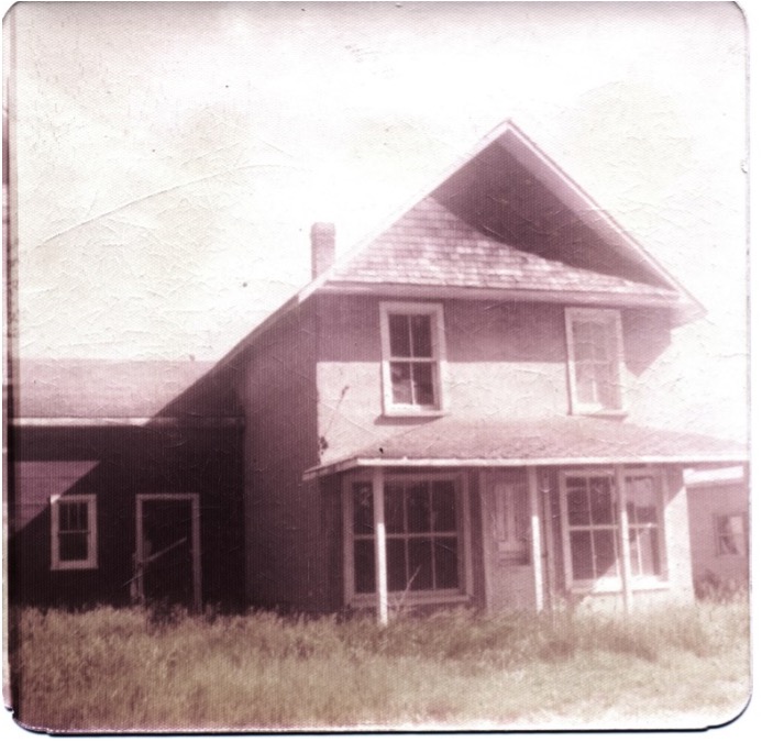
Who lived here? When? What else was this building used for? What was here before this building? What about other buildings surrounding this property? The Georgina Historical Society Board met in September 1974 for a regular meeting. Only a month previous, Georgina Township granted the GHS use of 10 acres on the property recently acquired by the township. The GHS was to develop a Historic Village. A building, referred to in the GHS Board Minutes as “Store at Baldwin” was discussed:
“Store at Baldwin: Price is $500- maximum of $2500 fee for moving to village site Problem: Building is cement clad and may not be movable—Mr. Harrison, the mover, will have to see the inside and foundation of the building”
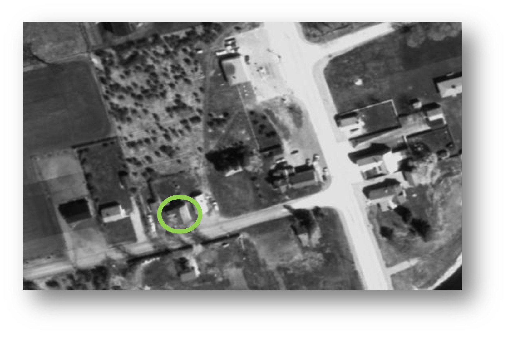
ABOVE: Aerial photo dated 1970. (www.YorkMaps.ca) The area circled in green shows the building in question. Highway #48 runs through the image from top to bottom. Bladwin Road is where the building was located

The building was located on the north side of Baldwin Road, just west of Highway #48. Until 1971, this side of the highway was North Gwillimbury Township, while the east side of the highway was Georgina Township. Very little historical background was included with the acquisition, but the GHS recorded that it was used as a residence and a harness shop by a man named Joseph Vanderburg.
Today, the Georgina Pioneer Village knows little more. Land records can shed light on the ownership of a property, but say very little with regard to building tenancy and use.

Thankfully, we had local correspondents writing about local happenings. The Newmarket Era newspaper reported the following:

May 26 1922: Jas. Owen, Ross O’Brien and Joe Vanderburg have buildings very close together. To insure themselves against loss by fire they thought it best to invest in some fire protection. They each purchased a fire extinguisher. No doubt they would be of some help in a conflagration.

October 12 1923: Joseph Vanderburg’s shop and dwelling are quite a pretentious building. The most of the rooms are in the second storey. Joe has to shovel out the money. It costs something to build these times.
November 23 1923: Joe Vanderburg’s new harness shop is finished and he is moving in.

December 21 1923: Who says Baldwin isn’t growing? Joseph Vanderburg is working in the shop attached to his new dwelling. The shop itself is most elegant and well lighted. When the weather gets warm enough to work barehanded they will finish the living rooms of the house. Joseph Vanderberg’s old work shop, after an attempt to move it bodily was torn down and the material toted away. Jas. Owen is moving the market building upon the site of the building just removed.

February 25 1927: Mr. Joseph Vanderburg is home, packing and getting ready to move to their new home at Guelph.

Between 1916 and 1923 Joseph appeared as a non-resident in the tax rolls on a small lot on the east side of Highway #48- the Georgina Township side of Baldwin. His occupation was listed at various times as a labourer, cobbler and saddler.

In 1924, 1925, 1926 he appeared on the tax rolls on the property associated with this building. Actually, he was assessed at ¼ acre of the south part of Lot 12 Concession 8 in North Gwillimbury Township. For now, we must proceed with the assumption that the lot where this building was in situ is the lot that is being referred to in the tax rolls.
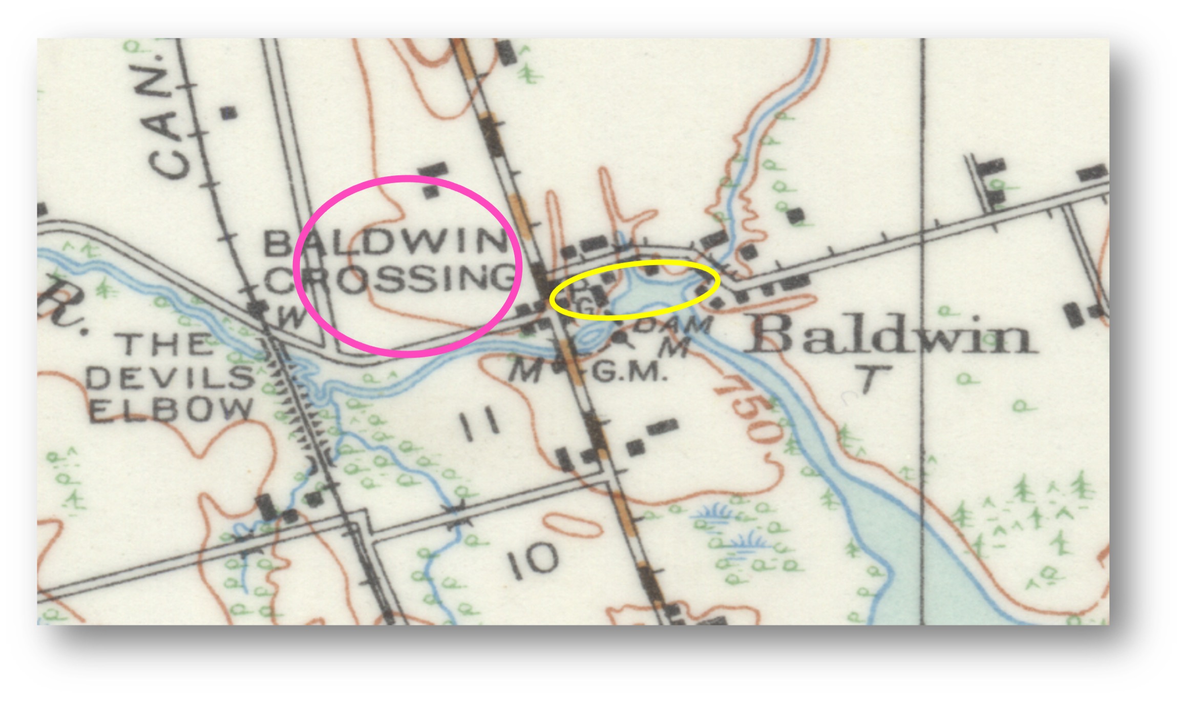
In the map below, the area circled in pink shows Lot 12 Concession 8, North Gwillimbury Township. The area circled in yellow shows Lot 1 Concession 4, Georgina Township, south of the road (Smith Boulevard), which is the area that describes the location of Joseph Vanderburg’s land in Georgina Township deeds.
Today, at the Georgina Pioneer Village, the front of the building represents a general store. The back explores barbering and a history of Tremayne’s Medical Hall. The hope is that we can expand on histories explored here to include information on the building, and its place within the history of Baldwin and surrounding areas. You can help the Georgina Pioneer Village and the Georgina Historical Society. If you have any knowledge of this property or building that can help us uncover its past, please contact us. We are collecting stories, memories, copies of photos and anything else that may shed light on this building’s past. The information you provide may be added to the Reference Collection to make this knowledge accessible for future researchers. This article will be the first of many seeking historical information. You can contact the Georgina Pioneer Village by email curator@georgina.ca and phone (905) 476-4301 ext. 2284. You may contact the Georgina Historical Society by email at georginahistoricalsociety@outlook.com or by contacting a member of the Board listed on the last page of this newsletter.

An Interesting Historic Structure: Jackson’s Point Marine Railway goes on display! By Paul Brady
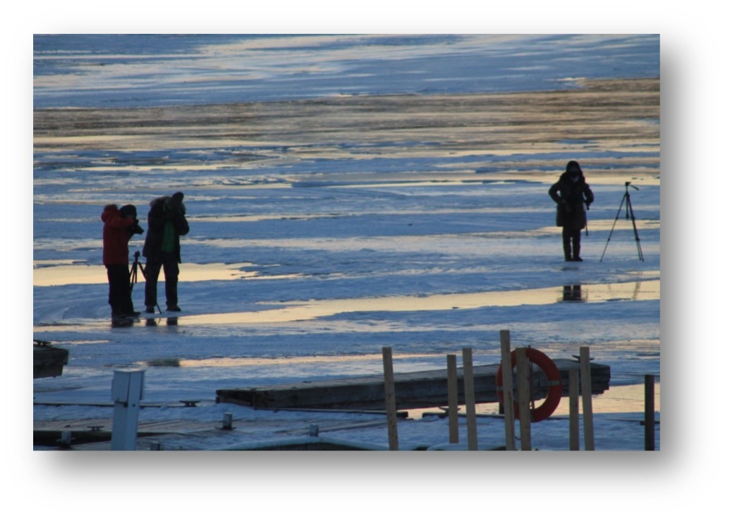
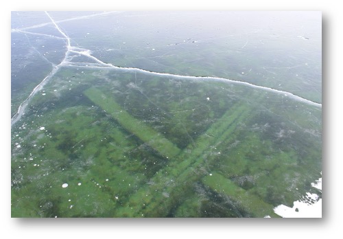
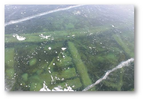
This past winter, a unique opportunity to glimpse the past was afforded us. With the warm fall and late freeze up of Lake Simcoe, the water around the historic Jackson’s Point harbour stayed open later than usual.
A normal winter has many freeze-thaw cycles in the early winter, resulting in rough, milky ice around the shore. The early winter of the 2020-2021 season, however, was warmer than usual, resulting in open water around the break-walls. When it did get cold the ice froze beautifully and the result was what is known as black ice, a solid, crystal clear ice that affords exceptional clarity.
As luck would have it, some of this ice formed above a structure dating back to pioneer days on Lake Simcoe. This structure is just off shore at the end of the Malone Road wharf, lying directly on the lake bed. Normally this structure is hidden from view under the water, only to be seen from a boat or by divers. The water is maybe four feet deep here but extends at a gentle slope to at least two hundred feet from shore, and about to about fifteen feet deep. The part of the structure that ran up onto the land is gone, removed long ago to allow a conventional boat launch, also now gone, to be constructed. The structure itself is an amazing artifact. It is about twenty feet wide, about two hundred feet long and three beams wide, joined about every ten feet by more beams. These beams are at least ten inches square. The outer beams have raised sides of smaller pieces of wood, creating a track about six inches wide. It is hard to see how the beams are attached.
So, what exactly do we have here? Often referred to as a dry dock, it is technically a marine railway, created to bring steam boats of over a century and a half ago out of the lake for repair or winter storage. It could possibly even date back to as early as the 1830’s. It is not related in any way to the Lake Simcoe Junction Railway which accessed the other side of the harbour at the end of Bonnie Blvd. The marine railway was built by enterprising entrepreneurs, intent on capitalizing on the only safe, deep harbour on Lake Simcoe’s south shore. This area was one of the earliest access points along the shore and indeed was, and continues to be, a safe shelter from the storms that create havoc on the lake. At that time a saw mill was located in the harbour creating lumber to be shipped south. Before the Lake Simcoe Junction Railway arrived in Jackson’s Point in 1877, this lumber would have been directed to Belle Ewart with steam powered boats to be shipped by rail from there. The steam boats worked on Lake Simcoe before roads, or even railways, were constructed. It is also surprising how big they were. The “Emily May”, for instance, was about 150’ long with a 22’ beam. We know from newspaper reports of the day that this was a very busy facility, accommodating repairs on boats such as the “Enterprise”, at one time owned by the same company that owned the marine railway, the “Lake Simcoe Transportation and Dry Dock Company”. This must have been a busy depot as it is possible that this marine railway/dry dock was the only one on Lake Simcoe. It was definitely the only one on the south shore, and almost certainly the last remaining one of this age and scale in Ontario.
The question is, how did it work? To get the boats out of the water, a carriage would need to be placed under the boat. Indeed, a cast iron wheel lay on the bottom for years until it mysteriously disappeared some time ago. How did they attach the carriage to the boat? The wheels of the carriage would have ridden in the tracks that we could see on the outer beams but how did they actually move the assembly? Did they use the sheer power of a team of horses or maybe a primitive engine of some sort? And once they got the boat out, how they put it back in? Lots of questions, but these were enterprising people and they obviously had these problems worked out. The area where the marine railway is located lies wholly within the water lot associated with the Malone Road wharf, owned by the Town of Georgina. The marine railway has had the interest of local historians for years. The current break walls, constructed in the late nineteen nineties, straddle the structure. The original plan for the break wall would have destroyed this artifact but community involvement intervened to save it. It is currently on Georgina’s Heritage List and a Heritage Designation is in the works, protecting it for future generations to study. Hopefully our current Town Council will be the one to finally give it the protection it deserves. This is the first time in my recollection that the marine railway has been so accessible. I am sure that black ice has formed above it before, but snow would have obscured it quickly. This year the snow stayed away for several weeks, and indeed the black ice created a wonderful skating opportunity that extended for about a kilometre along the south shore. It is interesting to think of such a seemingly fragile wooden artifact surviving under water for so many years, and that such an unusual set of weather conditions would let us appreciate its size and construction for such an extended period of time.

Of Marine Railways, Patent Slips and Slipways: A Brief History

(Adapted and condensed by Bob Holden from https://en.wikipedia.org/wiki/Patent_slip and other sources.)
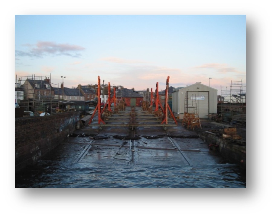
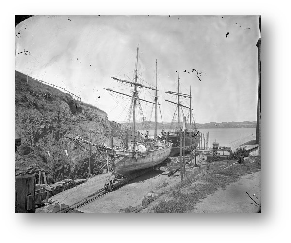
The patent slip or marine railway is an inclined plane extending from shoreline into water, featuring a “cradle” onto which a ship is first floated, and a mechanism to haul the ship, attached to the cradle, out of the water onto a slip. Invented by a Scot, Thomas Morton in the early 19th century, it was as a cheaper alternative to dry docks for marine vessel repairs, in particular below the waterline. Larger modern marine railways can handle vessels of thousands of tons.
Patent slip at Arbroath Harbour, Scotland https://en.wikipedia.org/wiki/Patent_slip
The process of slipping a vessel is an inexpensive and straightforward way to take a large vessel out of water for inspection, repair, or storage. In tidal harbors and ports, it is normally necessary to wait for high tide. In many cases, it is possible to take the vessel out of the water on one tide, and to make repairs and return it to the water on the next tide. The first step in use of a patent slip or marine railway system involves a “cradle” being lowered to the bottom of the inclined plane (the slip/slipway), at which point the vessel is moved into position directly above the cradle. The vessel is then be moored to the cradle with a number of ropes fore and aft to prevent the vessel from moving in any direction. Large marine railways and patent slips can handle vessels of 6,000 tons. In the mid-19thcentury the Crandall family of Boston, Massachusetts (Crandall 1967) developed their own peculiar system commonly referred to as a ‘marine railway’ or ‘railway dry dock’. They use live rollers instead of wheels and cradles built up aft to a wedge shape so that the line of the keel blocks is level. A smaller variant of this system may be seen in use all over our lake by cottagers to haul boats onto land or into boathouses for storage.
Evans Bay patent slipway, New Zealand www.nzhistory.net.nz
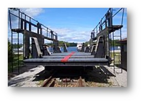
In addition, a patent slipway or marine railway can substitute for a traditional waterway lock in areas where the terrain is poorly suited to an installation of that kind. This would consist of a railway where two ends each access a body of water, with a dry high point in between. A working example still in use is the Big Chute Marine Railway in Ontario, Canada.
The old Big Chute Marine Railway, showing the cradle and rail system https://en.wikipedia.org/wiki/Patent_slip

Invented by shipwright Thomas Morton in 1818,[1][2] the patent slipway offered an alternative to the expensive and time-consuming process of dry docking a ship to perform maintenance or repairs to its hull below waterline. The means and mechanisms over time became various, but always include a “cradle” onto which the ship is floated, and a mechanical mechanism for transferring the ship from water to land up an incline. The destination where work was performed was termed the slip.


The earliest patent slipways used teams of men or animals to haul small vessels in wheeled cradles up the slipway. Later blocks and pulleys and large winches linked to heavy hawsers or chains gave a much greater mechanical advantage allowing larger vessels to be hauled up into a slip. As technology improved, animal and human muscle was replaced; first by steam engines, then later with internal combustion or electrical motors allowing much larger vessels to be hauled up the slipways.

1 Prosser, R. B. “Morton, Thomas (1781–1832), shipbuilder and inventor of a ship-building slip”. Oxford Dictionary of National Biography. Oxford University Press.

2 Morton, Thomas & John Barclay (12 March 1824). “Infringement of a patent: notes of a trial before the Jury Court at Edinburgh”. W. Reid & Son.

3 Stuart Cameron (2005) “The Patent Slip”, ClydeSite Magazine, Issue 5, Article 4 (23 March 2003), see [1], accessed 30 June 2014.

Also consulted: https://coms.events/pianc-panama/data/full_papers/full_paper_176.pdf and Crandall Dry Dock Engineers Inc (1967) Railway Dry Docks

Where in Georgina?

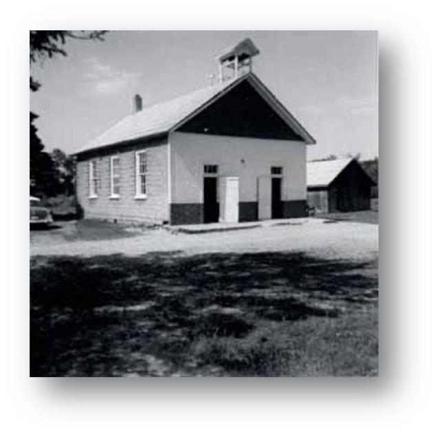
Left is our newest mystery location. Unidentified last month, what and where is it? Our last mystery location showed a Metropolitan radial car rounding the curve just north of Deer Park Drive in Roches Point. Dale Taylor once again correctly identified the location after a hint in December’s issue of our newsletter. Photo from Tom Glover
Bring and Brag

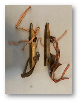
It is nice to see the abundance of skating rinks on our lake and rivers this winter. It certainly brings back memories of skating and pick up hockey games on small farm ponds growing up. Here is a picture of skates from earlier days. My older siblings taught me to skate on a little pond behind the barn and I remember wearing similar wooden skates. Very fortunate to obtain a pair a few years ago. Tom Glover (Photo by Tom Glover)


Our Bring and Brag meeting could not take place this year due to Covid. So we have decide to do our sharing in our newsletter. Do you have a Bring and Brag item that you’d like to share? Contact us with a photo, description, and a short story of how it was acquired and we’ll publish it.


News

Update on the Robert Johnston cemetery
There is a heritage cemetery located on the main street of Pefferlaw known locally as the Robert Johnston cemetery. Robert Johnston was a member of the founding family of Pefferlaw back in the 1820s and 12 members of his family are buried in this cemetery. It consists of a small plot of land that once belonged to Robert Johnston’s farm.

Recently, the Georgina Historical Society was advised that the new owner of the property where the cemetery is located was interested in moving the bodies buried there to a new location at the Cooke’s cemetery in Pefferlaw.

The GHS quickly became the champion of the cause to save the Robert Johnston cemetery.
We learned early on that the owner of the cemetery tried to do the right thing and offered to donate the cemetery to the Town of Georgina. However, according to the owner, the Town wanted more land than the owner was prepared to part with and the donation offer fell off the table.

One of the first things the GHS did was petition the Georgina Heritage Committee to designate it as a Heritage Site. And, although they have agreed to do so, this process became stalled once a Notice of Intention appeared in the paper to have the cemetery closed and moved.

With this information, the GHS quickly kicked into high gear and called on members and residents to engage in a letter writing campaign to the Ontario Registrar of Burial Sites requesting that any application to move the graveyard be denied. The response we received was awesome. In addition, we also received generous offers of support from Laura Suchan, Jane Cooper Wilson and Marjorie Stuart with the Ontario Historical Society and Fred Robbins with the York Branch of the Ontario Genealogical Society. All of these individuals have had experience in preserving Ontario’s heritage cemeteries. Thank you!

Next, we were eager to make contact with the owner of the cemetery to find out if the offer to donate the property could be put back on the table. He was a very gracious and polite individual and our conversation was congenial and positive. We both voiced our concerns and end goals which led us to mutually respect each other’s positions. While nothing was settled, the tone of our discussions was upbeat and we did agree to keep the lines of communication open.

At this stage, we think there is room for optimism. Both sides are admitting there is an opportunity to come together to try and find a solution that could result in is a win/win for everyone. We will be staying in touch to discuss further developments as they arise.

You may voice your opinion by writing to:
   Registrar of Burial Sites Consumer Services Operations Division Ministry of
   Government and Consumer Services
   56 Wellesley Street West, 16th Floor, Toronto ON M7A 1C1
   Email Nancy.Watkins@ontario.ca

We appreciate your support in this matter.


Events

Due to Covid our events remain on hold. We will keep you updated with any changes to that status.
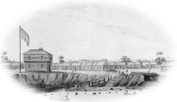
Early sketch of York Barracks U.C.