Click to Download the PDF
Download the Word Doc
President’s Message
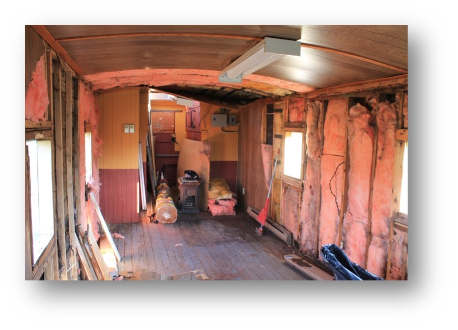
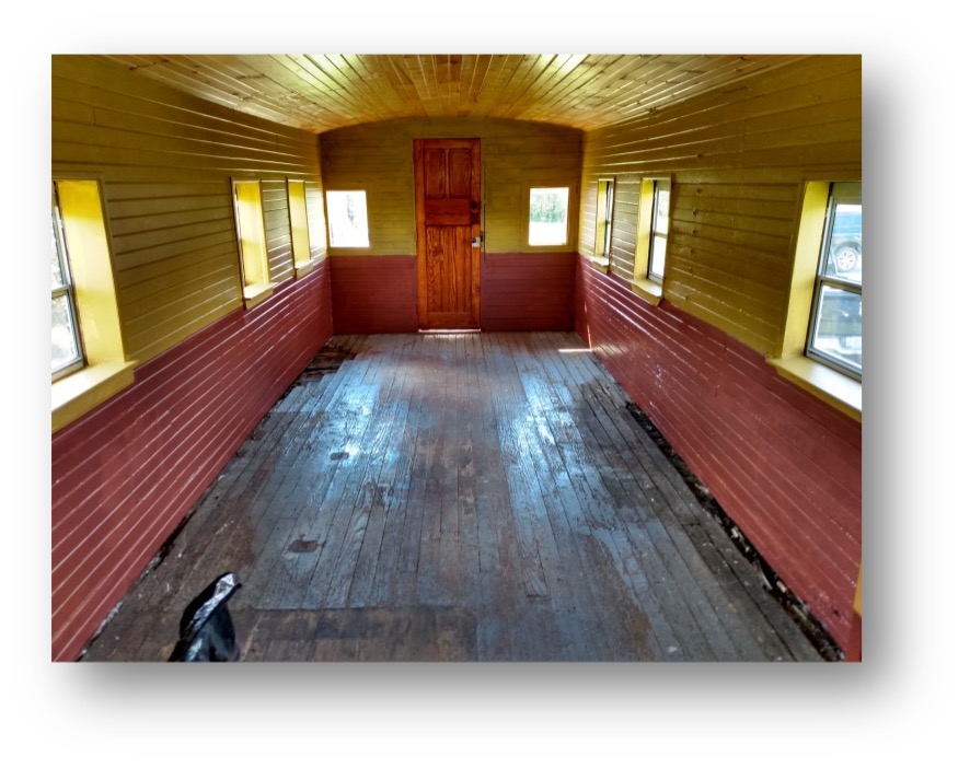
More thanks goes out to our caboose crew, Paul Brady, Wayne Phillips and Cliff Williams. A big welcome back goes to Melissa Matt who has returned from her stint at the Covid vaccination clinic to her role as curator at the Village. Rich, our valued maintenance man has completed repairing and painting the radial stations and has started some much need repairs to the bandstand. Construction of the replica Cedarbrae School is underway. The concrete work is completed and lumber has arrived awaiting the next phase. As always a big thank you to our town staff, Jodi, Melissa, Shaun & Rich for planning, coordinating and carrying out all the work in the Village.
Once again, thank you to Paul and Kim Brady for letting the GHS take part in their garage sale. A total of $1050 was raised for the GHS from sales and generous donations from Paul & Kim Brady and Wayne Phillips. Thanks to all of you who helped the “Friends of the Parish Hall” with their yard sale. Your hard work helped them raise almost $4500 towards the repairs needed to renew the hall…A very worthy project! As covid precautions continue the GHS is continuing to limit our indoor activities.
Hopefully, by late fall we will be able to resume our normal events.
We have tentatively scheduled our 2021 Annual Meeting for Thursday, November 19. Details will follow when we are able to confirm a venue and Covid protocol for that time. At our 2021 Annual Meeting vacancies for vice president, treasurer and director will need to be filled. If you are interested in joining the GHS Board please let us know.
Looking forward to seeing everyone soon…take care…stay safe.
Tom Glover
GHS President
Beechcroft in Roches Point by Paul Brady
A recent real estate listing has given us a rare glimpse behind the hedges of one of Georgina’s most exclusive pieces of real estate. Beechcroft, registered with the Government of Canada as a National Historic Site, is now on the market. With a list price of $18,000,000 and with the municipal taxes approaching $1,000 a week, the purchaser is going to need a pretty fat purse.
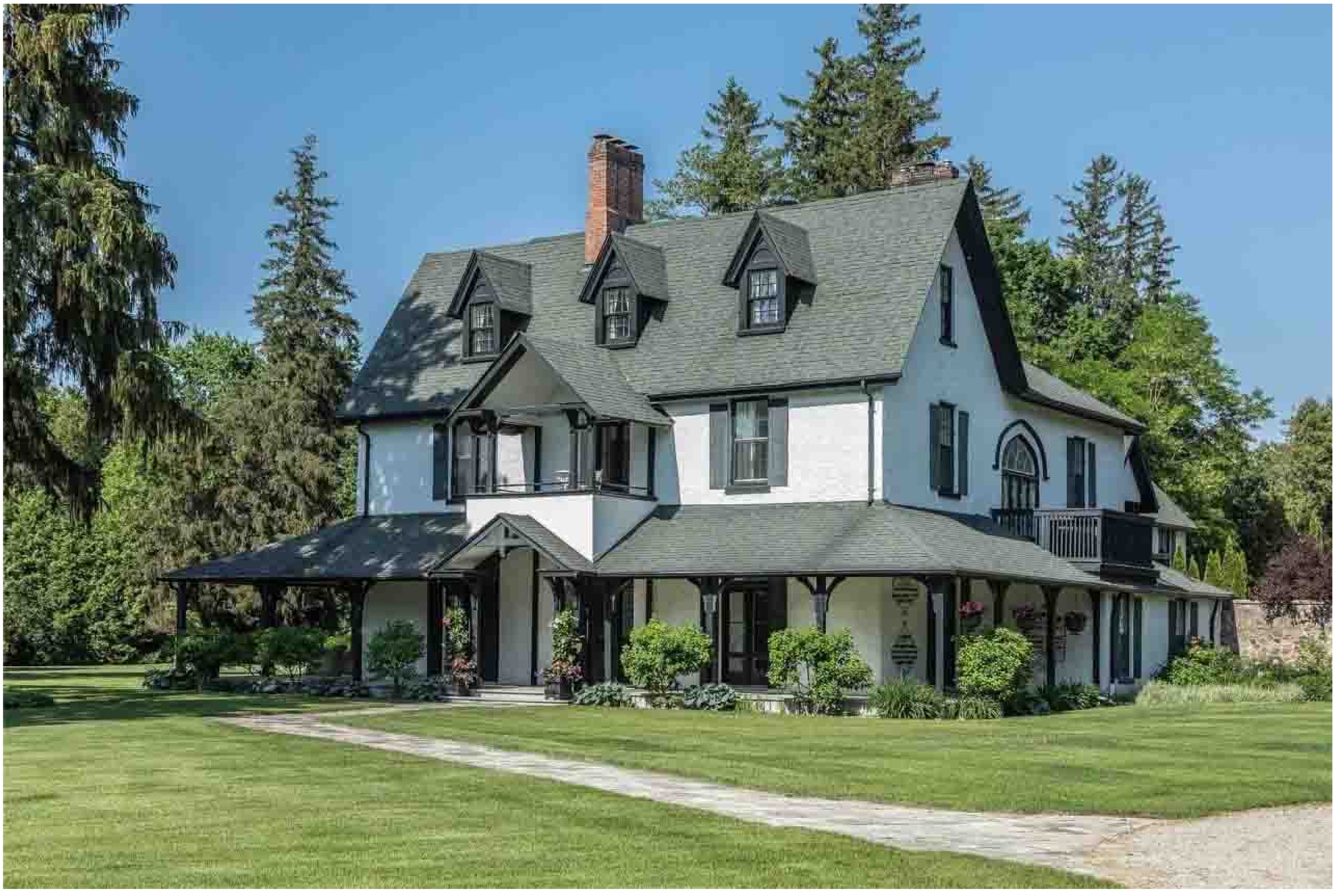
One of the earliest dwellings along “Millionaire’s Row” in Roches Point, this iconic property includes over six acres of land and 542 feet of prime Lake Simcoe waterfront. With stunning western views, glorious sunsets and over 9,000 square feet of living space, this is indeed a once in a lifetime opportunity to enjoy the good life. It was originally built about 1861 for the man who created Roches Point’s wonderful Christ Church, Reverend Walter Stennett. He was a retired principal of Upper Canada College and had come to the area to convalesce after suffering a nervous breakdown.
Beechcroft was purchased for $5,000 soon after by a flamboyant American lumber baron by the name of Anson Green Phelps Dodge. This was 1870, and the property then included 115 acres of land. A.G.P. Dodge had come up from the United States in pursuit of the thousands of acres of virgin forest still standing in the Muskoka area.
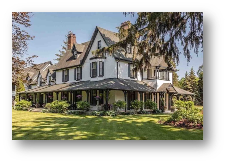
I do not know why he settled in Roches Point, as the rail link for the lumber markets to the south was located on the other side of Cook Bay at Belle Ewart, but he quickly put his own personal spin on the property. Adding extensions, gables and a wrap-around verandah, his crowning touch was hiring Frederick Law Olmstead of New York to design his gardens. It is said that Olmstead was the father of American garden architecture and, with his partner Calvert Vaux, designed New York’s Central Park along with many other urban landscapes. Beechcroft’s gardens still exist and are one of the selling features. A.G.P. Dodge went on to become president of the Lake Simcoe Junction Railway while it was still in the planning stages, so maybe that was why he had settled on this side of Cook’s Bay, to establish his own rail link for his lumber dynasty. He also ran for, and won, the federal seat for York North. However, it was not to be, as his empire started to crumble due to several scandals involving forged endorsement letters and questionable business deals.
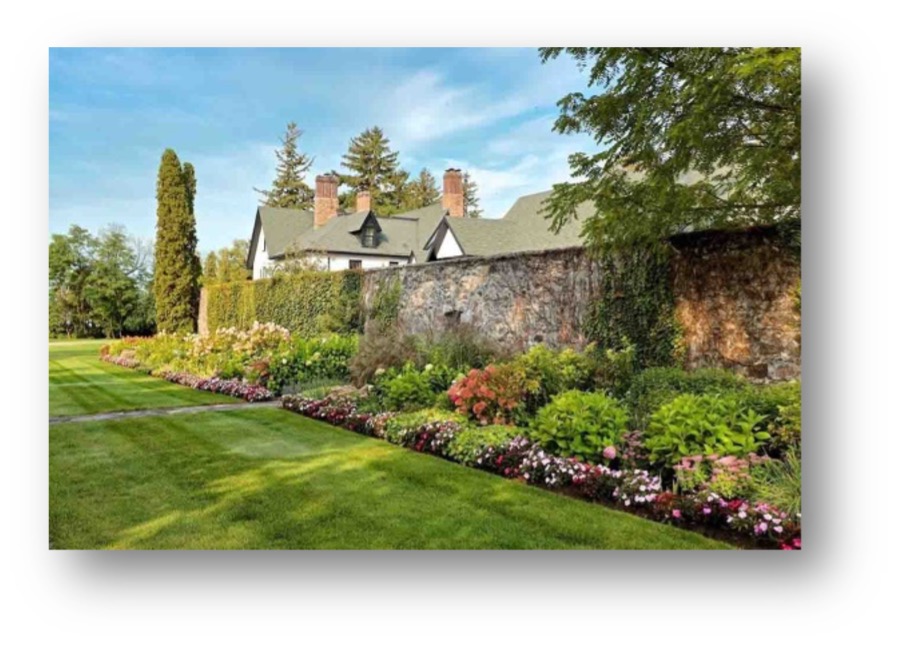
Lavish spending and fat expense accounts by himself and his managers, along with debts incurred acquiring property and equipment, added to his woes, but a recession sealed the deal and he lost Beechcroft to bankruptcy by 1873. He went back to the States to manage his father’s businesses and died in 1918. Meanwhile, Beechcroft was sold to Toronto based businessman Walter Gillespie and by 1883 had been used as a summer residence, school for clergy, hotel and rooming house.
Beechcroft has changed hands since then and was featured in an article in the Globe and Mail newspaper dated August 3, 2007. At that time, it was owned by an interior decorator who was not afraid to change things and had brought the elegant old place up to date, circa 2007. The current listing shows and describes a tasteful presentation and the magnificent property appears to be what one would expect it to be. The acreage of the property has been reduced over the years and is presently listed at 6.37 acres with 524 feet of waterfront. It boasts 9 bedrooms, 8 bathrooms, 2 kitchens, sunroom, library, family room, dining room, living room and a great room. There is a boat house and permanent dock with a Tiki bar, and to keep yourself in shape there is a putting green and a basketball and tennis court. There are also 20 parking spaces and an attached garage.
I wonder if Reverend Stennett would have thought, back in 1859 as he planned the basis of this magnificent building that it would still exist in 2021. We can only hope that whoever purchases Beechcroft will respect the rich history of this property. Although not open to the public, it has been part of the lore of Georgina for over a century and a half, and I am optimistic that it will still exist to be admired as a showcase of history, taste and elegance a hundred and sixty years from now.
The Sutton Grist Mill
By Tom Glover
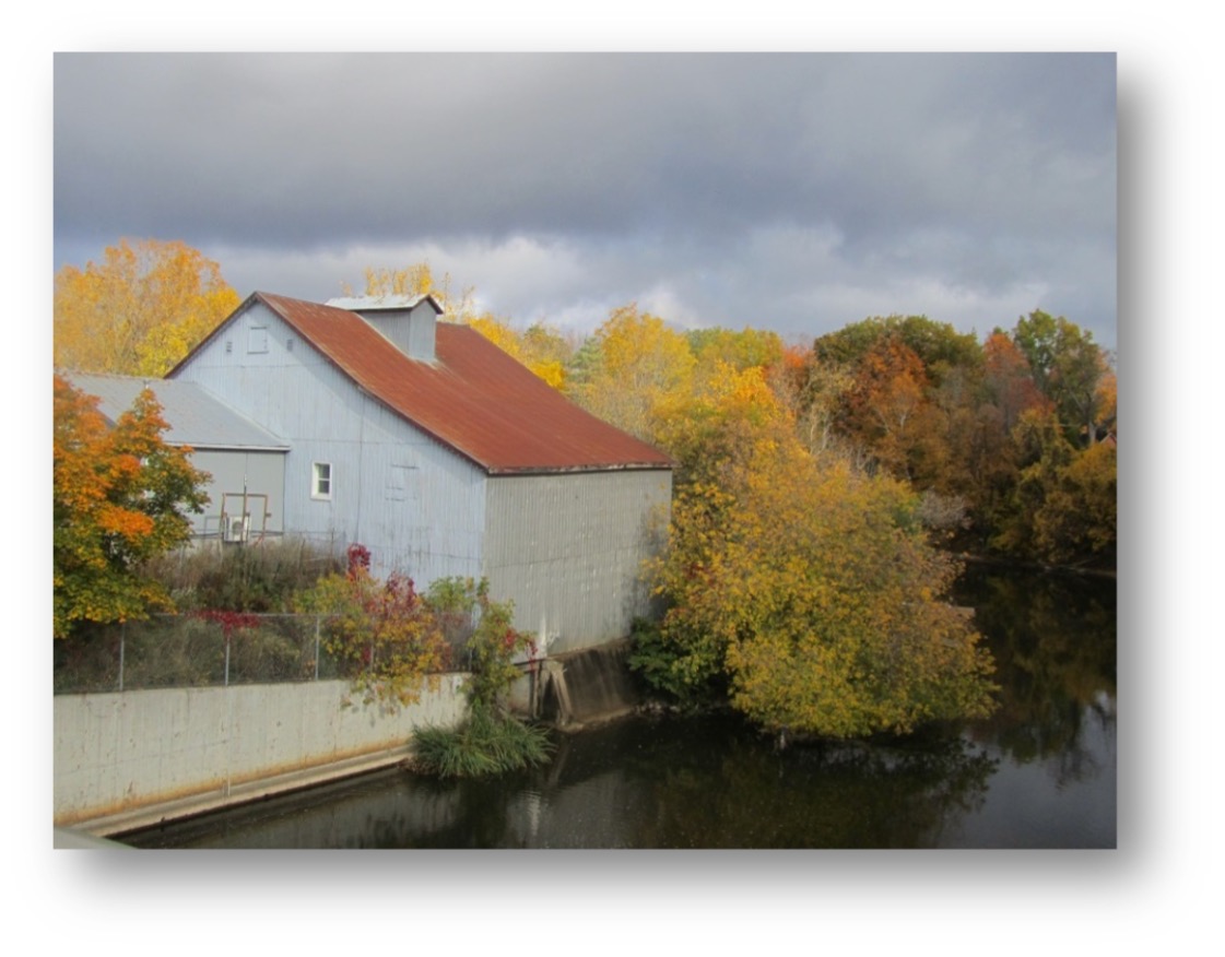
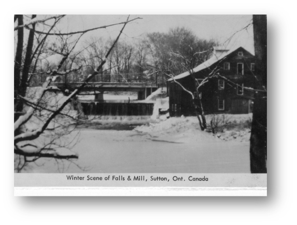
Today all that is available to be purchased at the old mill is ice cream treats in the summer time.
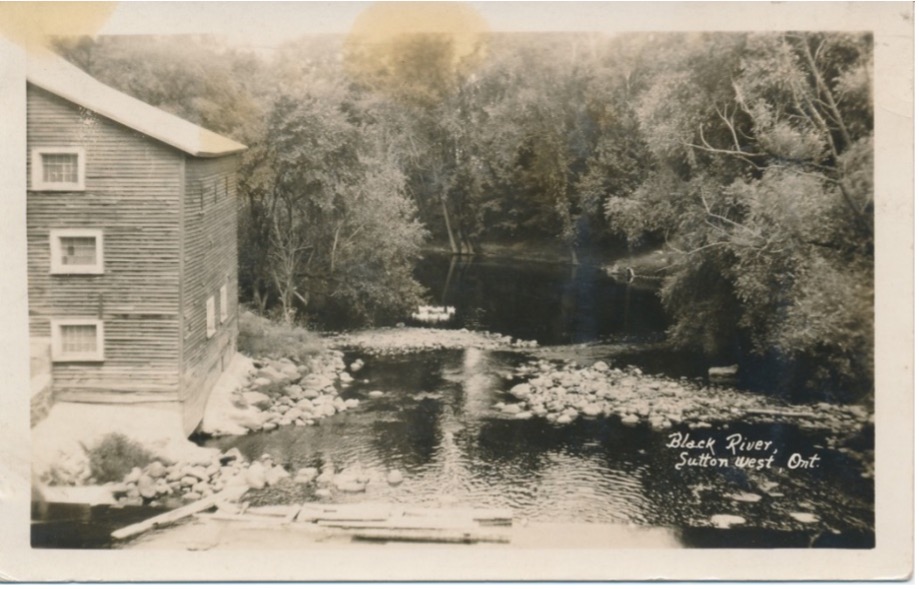
Where In Georgina?
Some Highway History…King’s Highway 48
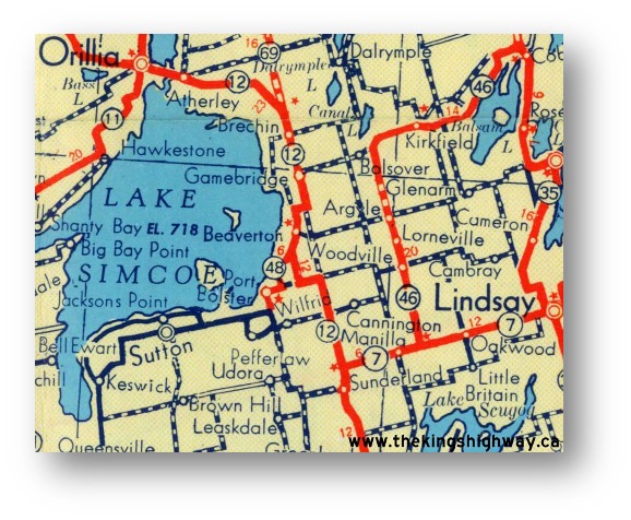
Highway 48 was first designated as a provincial highway in the late 1930s. Initially, It was just a short connector highway which linked Port Bolster to Highway 12 near Beaverton. A Preliminary Route Plan was prepared dated June 26, 1935, indicating the intention of the Department of Highways of Ontario (DHO) to assume ownership of the Port Bolster Road as a King’s Highway (see 1953 map to left). This tiny highway was only 10 km (6 miles) in length when it was first assumed as King’s Highway 48 by the DHO on March 24, 1937. The original 1937 route of Highway 48 began at the Highway 12 Junction just south of Beaverton, as it existed in 1937.
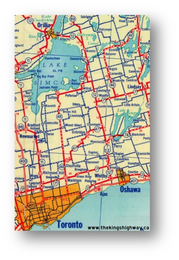
Highway 48 was extended easterly from Highway 12 to the Highway 46 Junction at Bolsover during the early 1960s. A Preliminary Route Plan was prepared in July 1961, showing the proposed extension of Highway 48 along the Portage or Bolsover Road between the Highway 12 Junction at Gamebridge and the Highway 46 Junction at Bolsover. Designated as King’s Highway 48 on July 20, 1961, this new section of the highway was connected to the existing southern section from Toronto to Beaverton. The section of Highway 48 between Beaverton and Gamebridge was designated concurrently with Highway 12. This routing with Highway 12 also meant that a short section of Highway 48 from Beaverton to Gamebridge was considered to be a part of the Trans-Canada Highway. Following the extension of Highway 48 to Bolsover in 1961, the route of Highway 48 was 102 km (63 miles) in length. In the mid-1960s, a new bypass was constructed around the south side of Beaverton (see map of 1967 bottom right last page). The new route for Highway 48 bypassed the awkward old 1930s-era route of Highway 48 through Port Bolster and Beaverton.
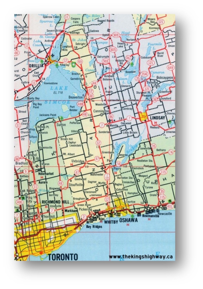
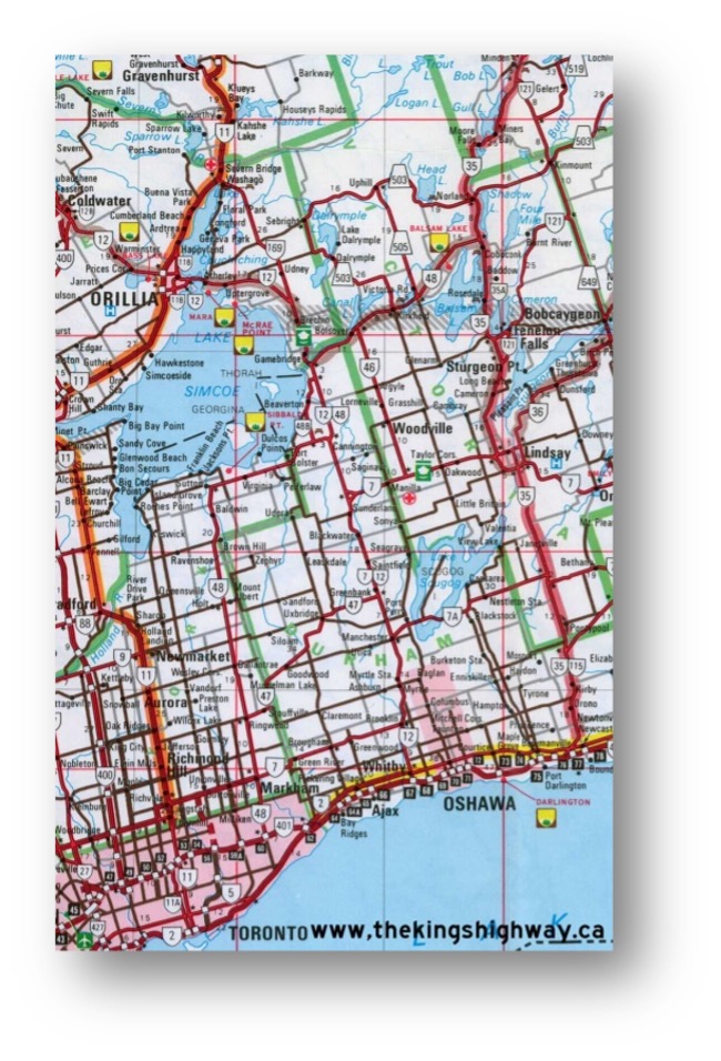
During the late 1990s, the northern section of Highway 48 also experienced significant changes. The north section of Highway 48 was one of the casualties of the mass highway downloading in Ontario in 1997-1998. On January 1, 1998, the entire 36 km section of Highway 48 between the Highway 12 Junction near Gamebridge and the Highway 35 Junction in Coboconk was transferred to the Regional Municipality of Durham and Victoria County (now the City of Kawartha Lakes). This section of the highway is known now as Durham Highway 48 and Kawartha Lakes Road 48. The former concurrent routing of Highway 12 & Highway 48 near Beaverton was discontinued in 2004, since the route of Highway 48 no longer continued north of Beaverton. As a result of the 2004 highway renumbering, Highway 48 now ends at the Highway 12 Junction south of Beaverton. This has also resulted in a discontinuation of Highway 48 as a Trans-Canada Highway route, since Highway 48 no longer shares part of its route with Highway 12.
Highway 48 traverses mostly rural portions of Central Ontario, though just west of this highway there is much suburban development as population shifts northward from Toronto. The highway passes through a handful of smaller towns and communities along its 70 km route, but the only really large centre is Markham, located at the southern end of the highway.
Adapted by Bob Holden for the newsletter: http://www.thekingshighway.ca/Highway48.htm
(Photo courtesy of Ontario Ministry of Transportation – © Queen’s Printer for Ontario, 2011)

News
Here are some more photo updates of the progress on our caboose project courtesy of Paul Brady. Well done guys!
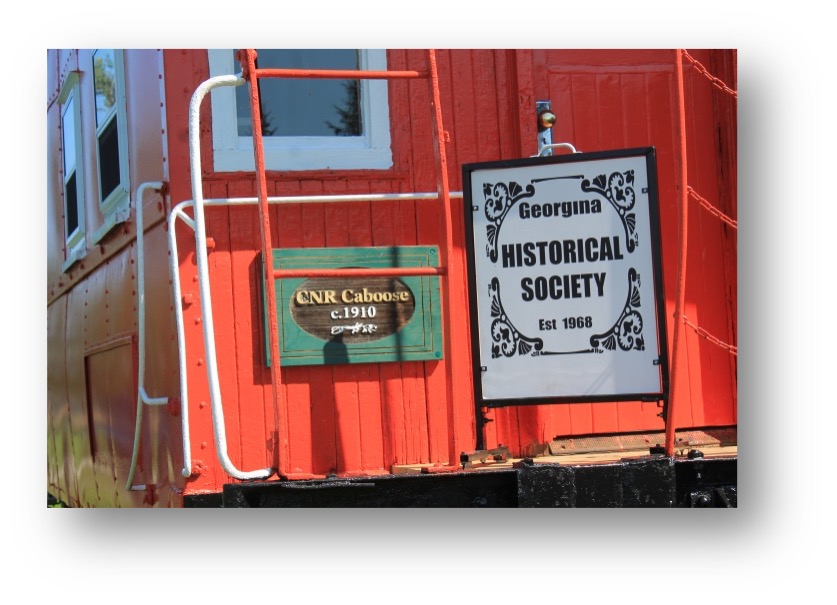
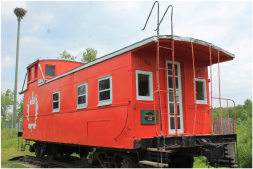
BEFORE
AFTER
Events
Most events will remain suspended due to COVID. We will notify you if there are any changes in that status.
October 4th – Board meeting at Pioneer village; 2PM and exact location to be announced
